With around 8,200 paths and almost half the county designated a National Landscape walks in Wiltshire has never been better.
Whether you choose a gentle stroll or want a more challenging route, there is a network of footpaths for everyone.
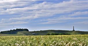
Wiltshire walks offer peaceful, glorious countryside and will show you rural England at its very best. There are a great variety Wiltshire walks: something for everyone, from the long distance treks to afternoon strolls. Take time out to explore our timeless nature.
Local walking tour companies
If you are looking to do a walking tour that uses local paths and trails then check out tours with Guided Walks in Wiltshire, Footpath Holidays.
Foot Trails offer self guided walking with accommodation in the Wiltshire area.
Self-guided walks
Browse below for a variety of great self-guided walks in Wiltshire which can be downloaded. Every effort is made to ensure the accuracy of these walks but please check details with the local Tourist Information Centre before visiting.
You can also find more inspiration for self-guided walks on the Wiltshire Walks app. Wiltshire Walks have put together some walks for a number of Wiltshire towns and areas to get you inspired:
Salisbury
Marlborough
Castle Combe
Swindon
Malmesbury
Stonehenge
Devizes
Chippenham
Cranborne Chase
Walk 1 - Barbury Castle and the Ridgeway
8 km/ 5 miles 1 hr 30 mins - 2 hrs Easy
A delightful downland walk for a clear day. Part of the route is along the Ridgeway, said to be Europe's oldest road. The Iron Age hill fort of Barbury Castle is believed to be the site at which Cynric defeated the Britons in 556AD.
Download this walk
Walk 2 - Lacock
4 km/ 2.5 miles 1 hour Easy
This beautiful National Trust village is one of Wiltshire's real gems. With houses dating from the 13th century, a majestic abbey and winding streets to explore, you will certainly want to set aside some extra time to explore. The abbey became the home of William Fox Talbot, pioneer of photography, and a museum commemorating his work is situated outside the abbey gates.
Download this walk
Walk 3 - Bishops Cannings
8 km/ 5 miles 1 hr - 1 hr 30 mins Easy
This walk includes sections along the Kennet and Avon Canal and The Wansdyke, a great bank and ditch earthwork, thought to have been constructed in the Dark Ages following Roman occupation.
Some parts of the walk may be muddy and strong shoes or boots are recommended.
Download this walk
Walk 4 - Great Bedwyn and Wilton Windmill
9 km/ 5.5 miles 1 hr 30 mins Easy
This route takes in part of the Kennet and Avon Canal towpath, as well as Wilton Windmill, the only working windmill in Wiltshire, and the world's oldest working beam engine at Crofton Pumping Station.
Plus it's easy walking!
Download this walk
Walk 5 - Bratton and Westbury White Horse
6 km/ 3.75 miles 1 - 2 hours Moderate
An enjoyable and undulating walk presenting fabulous views from the northern aspect of the Imber Range Perimeter Path.
Beginning in the village of Bratton, the route takes in Westbury White Horse.
From the superb vantage point at the Horse, on a clear day Cherhill and Alton Barnes Horses can also be seen in the distance.
For history lovers, the walk passes through 'Bratton Camp', an Iron Age hill fort.
Download this walk
Walk 6 - West Lavington and Salisbury Plain
9.6 km/ 6 miles 2 hours Moderate
West Lavington is situated in the heart of Salisbury Plain, and the village itself is so long that it has joined with the adjacent hamlet of Littleton Pannell.
The first part of this walk is on the Wessex Ridgeway, which then meets the Imber Range Perimeter Path for a short while, before dropping back into the valley and returning to the village.
Magnificent views across the hills, woods and villages can be savoured, along with unusual flora and fauna.
Download this walk
Walk 7 - Norton Bavant and Scratchbury Hill
5.3 km/ 3.25 miles 1 hour Moderate
This walk takes in several Iron Age hill forts that are a common feature of the chalk uplands of Wiltshire, including Scratchbury Hill - one of the finest hill forts in the area.
Views from the Imber Range Perimeter Path are far ranging, particularly eastwards towards the military training grounds of Salisbury Plain.
Download this walk
Walk 8 - Edington
8 km/ 5 miles 2 hours Moderate
A varied walk that combines a wide range of countryside habitats with fabulous views.
There are interesting churches to visit en-route and several nearby pubs for sustenance after the walk!
The route takes you up Edington Hill and onto the Imber Range Perimeter Path (IRPP).
Edington has its place in history as the site where King Alfred, in 878, gained a decisive victory over Danish invaders - ensuring the continuing existence of Wessex as an independent kingdom.
Download this walk
Walk 9 - Upper Woodford Valley
10.5 km/ 6.5 miles 3 hours Easy
Explore some of Wiltshire's finest villages and inns, delight in the natural beauty and crystal clear waters of the River Avon.
Go the added mile and enjoy stunning views of Stonehenge from the tumuli at Normanton Down.
Download this walk
Walk 10 - Lower Woodford Valley
6.5 km/ 4 miles 2 hours Easy
This is a short walk with two river crossings, capturing some of the best river and architectural views of the Woodford Valley.
Download this walk
Walk 11 - Woodford Valley
12 km/ 7.5 miles 3hrs 30 mins Easy
Explore the Lower Avon valley taking in Old Sarum and Great Durnford on the way back to Middle Woodford.
Download this walk
Walk 12 - Wilton and Wylye Valley
13 km/ 8 miles 2hrs 30 mins - 3 hrs Moderate
Visit Wilton and the tranquil tree-lined avenues of Grovely Wood. Descend into the beautiful Wylye River Valley and explore Great Wishford before returning to Wilton along the valley.
This walk is particularly special in spring when carpets of bluebells light up the forest floor.
Download this walk
Other walking routes to enjoy:
Other walking routes and maps are available to download from the Connecting Wiltshire website.
Walking friendly accommodation
Many of our accommodation establishments have the ‘Walkers Welcome’ symbol and provide extra facilities such as drying rooms for wet clothing they are also often able to advise on their favourite local routes. Search for your ideal walking break in Wiltshire.
Planning your next walking trip
Whether you are a casual walking enthusiast looking for a change of scenery or serious walker looking to challenge yourself on some new routes, Wiltshire will not let you down!
To make the most of our walking routes in Wiltshire, why not make a break of it?
To help get you started we have enclosed some links below to the more popular pages on our site.
There you can get the latest information on accommodation, attractions as well as different places to visit on your walking travels.


 to add an item to your Itinerary basket.